






Super GeoGPS

Super GeoGPS açıklaması
This is the best tool for those working in surveying, mapping, construction, transportation, planning... It supports high precision GPS and Glonass navigation in fieldwork surveys.
This tool is designed for Civil Engineer, Surveyor, Civil Surveyor, Land Surveying and Topografia
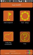
The typical functions of Super GeoGPS:
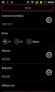
★ Super GeoGPS: Available many common reference systems, allows to set up more other reference systems.
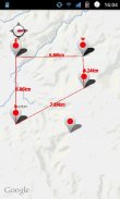
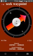
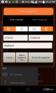
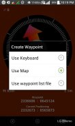
★ Super GeoGPS: Easy to finding waypoint on any reference coordinate systems by display direction, compass, distance, load Google maps. (for Civil Engineer and Surveyor)
★ Super GeoGPS: Easy to use 7 transformations parameters in order to automatically convert between Geographic and UTM Coordinates. Synchronize Google map with UTM zone.
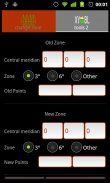
★ Super GeoGPS: Support convert between Geographic and UTM coordinates. Convert UTM coordinates between different zone.
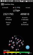
★ Super GeoGPS: Measuring current waypoint high precision. Routing and automatically collect coordinates on the way by cycle preset then create a text file coordinates to easily attach to email or export to your computer.
★ Super GeoGPS: Avoid stray is tool will marking point along the way and shows direction to come back, It support those who take the survey in the forests and mountains, sea, or traveling.
★ Super GeoGPS: Support GPS and Glonass
- Geological Compass tool
- Management of waypoint file (multi waypoint file)
- Export waypoint file to excel or text file
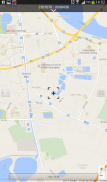
- Touch on Google map to add point
- Calculate the area (2D)
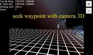
- Geological camera
- Compass adjustment
★ Super GeoGPS
- Fast config
- Add all of WGS84 central meridian.
- Tools for measuring distance between 2 devices
★ Super GeoGPS - Geodetic coordinates/UTM with:
- WGS1984
- WGS1972
- NAD1983/1927
- VN2000, HN1972
- Austria NS
- Belgium 50
- Nouv Trig de France 1
Super GeoGPS support 6 common language in the world (English, French, Chinese, Russia, Spanish and Vietnamese)
Bu planlama, ölçme, haritalama, inşaat, ulaşım çalışanlar için en iyi araçtır ... Bu saha araştırmalarında yüksek hassasiyetli GPS ve GLONASS navigasyon destekler.
Bu araç İnşaat Mühendisi, Surveyor, Sivil Surveyor, Arazi Etüt ve TOPOGRAFIA için tasarlanmıştır
Süper GeoGPS tipik fonksiyonları:
★ Süper GeoGPS: Mevcut birçok ortak referans sistemleri, daha başka referans sistemleri kurmanızı sağlar.
★ Süper GeoGPS: Google haritaları yüklemek, ekran yönü, pusula, mesafeye göre koordinat sistemleri herhangi bir referans yolnoktasını bulma kolay. (İnşaat Mühendisi ve Surveyor için)
★ Süper GeoGPS: otomatik Geographic ve UTM Koordinatlar arasında dönüştürmek için 7 dönüşümler parametreleri kullanımı kolay. UTM bölge ile Google haritasını senkronize edin.
★ Süper GeoGPS: Destek Coğrafi ve UTM koordinatlarını arasında dönüştürme. Dönüştürmek UTM farklı bölge arasında koordine eder.
★ Süper GeoGPS: Mevcut yol noktası yüksek hassasiyet ölçümü. Yönlendirme ve otomatik olarak daha sonra bir metin dosyası bilgisayarınıza kolayca e-posta veya ihracat eklemek için koordinatları oluşturmak çevrim ön ayarı ile yolda koordinatları toplamak.
★ Süper GeoGPS: başıboş kaçının aracı yol boyunca gelin işaretleme ve deniz, ya da seyahat ormanlar ve dağlar, içinde ankete katılmak isteyenler destek, geri gelmek için yönünü gösterir edecektir.
★ Süper GeoGPS: Destek GPS ve GLONASS
- Jeolojik Pusula aracı
- Yol noktası dosyası Yönetimi (çoklu geçiş noktası dosyası)
- İhracat noktası dosyası excel veya metin dosyası için
- Google'da Dokunmatik noktası eklemek için harita
- Alanı (2B) hesaplayın
- Jeolojik kamera
- Pusula ayarı
★ Süper GeoGPS
- Hızlı yapılandırma
- WGS84 merkezi meridyen tüm ekleyin.
- 2 cihaz arasındaki mesafeyi ölçmek için Araçlar
★ Süper GeoGPS - Jeodezik koordinatları / ile UTM:
- WGS1984
- WGS1972
- NAD1983 / 1927
- VN2000, HN1972
- Avusturya NS
- Belçika 50
- Nouv Trig de France 1
Süper GeoGPS dünyada 6 ortak dil desteği (İngilizce, Fransızca, Çince, Rusya, İspanyolca ve Vietnamca)


